


Flow of contract-based analysis service (Comprehensive Consulting)
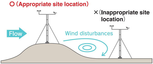
Figure 1. As with wind turbines, observational poles
need to be set up in areas with few wind disturbances.
Wind simulation enables the search for such areas.
Contract-based analysis service 1
Micro-siting service based on GIS (Geographic Information System)
【Search for potential areas for wind power generation facilities】
 Selection criteria for potential areas of wind power generation facilities
- Minimum annual mean wind speed at 70m above the ground surface: 6m/s
(NEDO “local wind map” 500m grid data) - Availability of access roads with a minimum width of 5m
- Legal regulations on the influence on the environment
(e.g. Natural Parks Act, Forest Act, and Agricultural Land Act) - Other criteria
(Power transmission lines, noise of wind turbines, presence of rare plants and animals, angles of topographical slopes, landscape aesthetics, and understanding by local residents)
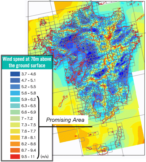
Figure 2. Wind maps of NEDO can be loaded into GIS
・Publicly available data with missing data entries are converted to a seamless map
・Sites with an annual mean wind speed of 6m/s or higher can be searched for easily and efficiently
(Applicable for all districts across Japan).
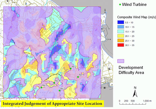
Figure 3. An example of the selection of a potential area for wind turbine installations after a search with the use of wind synopsis maps and various GIS data
Contract-based analysis service 2
Micro-siting service with RIAM-COMPACT® Natural Terrain Version
【Detailed evaluation of the potential area for wind power generation facilities】
Phase 1: Understanding of qualitative wind characteristics at the
candidate site
With the results of the micro-siting, “wind paths” and “wind disturbances” at the candidate site for a wind power generation facility are animated for visualization, and qualitative wind characteristics are evaluated.
Various GIS data can be superimposed with a linkage to GIS.
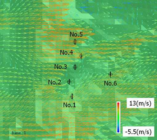
Figure 4. Wind velocity vectors at the wind turbine hub-height
 Visualization Gallery
Phase 2: Detailed evaluation of annual energy generation and of wind
turbine deployment
High-resolution wind simulations are performed with elevation data that are constructed with a spatial resolution of 10m or less.
By taking the observational data from the candidate site into consideration, we estimate the annual energy generation (kWh), assess wind disturbances (terrain-induced turbulence) and propose a plan for appropriate wind turbine deployment.
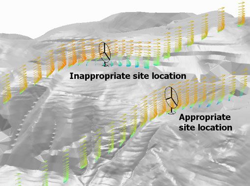
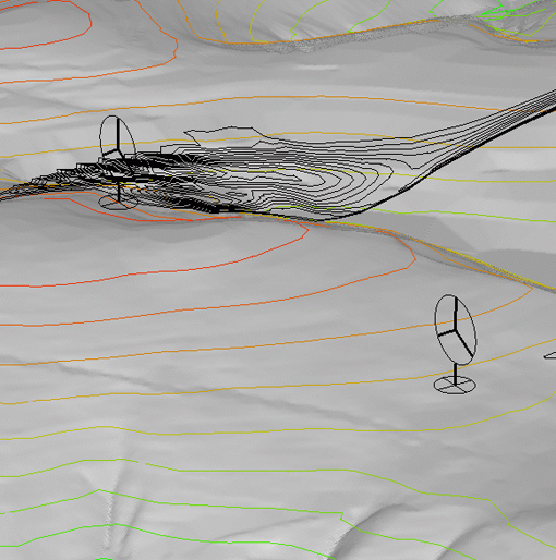
Figure 5. Assessment of wind disturbances caused by terrain irregularities
(terrain-induced turbulence)
Visualization Gallery