


Landscape simulation service
We create animations of the planned sites for wind power generation facilities. For these animations, we superimpose aerial photos on the 50m elevation data from the Geographic Survey Institute of Japan and insert wind turbines of the proper scale into the animations.
These animations allow viewing of the proposed sites of wind power generation facilities from various angles prior to wind turbine installation.
Options for the landscape simulation service include the use of 1) high-resolution elevation data (3D terrain model) created by our corporations and 2) Google Earth, a “digital globe software,” which allows access to satellite and aerial photos from all over the world.
 Time required
- Approximately two weeks for each site (general guideline)
Fee for animation creation
- Please contact us for estimates.
- The fee for a typical case is approximately 100,000 yen.
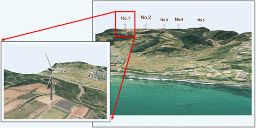
Figure 1. An example of an animated landscape with the use of high-resolution elevation data created by our corporations.
The animation provides a visual impression of the site including the rotating blades of the wind turbine, the view of the site from aloft and at eye level, and the site's integration with surrounding houses.
Such visual information allows inspection of the landscape with the installed wind turbines from various view angles.
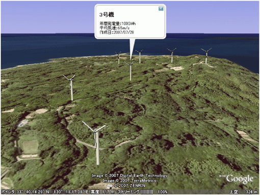
Figure 2. An example of an animated landscape viewed with Google Earth
 Visualization Gallery